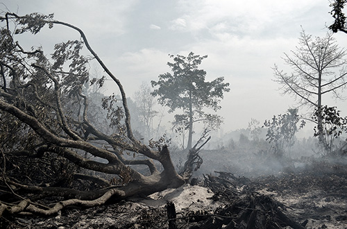
Jakarta (Greeners) – Government is preparing a grand design to prevent Indonesia’s annual forest, land, and plantation fires, which would involved 17 ministries, 66 districts/cities and 731 villages, said deputy of planning and cooperation, Peatland Restoration Agency, Budi Wardhana, in Jakarta, on Monday (19/12).
The preparation would begin in 2017 to 2019 with the agency’s main role was to provide fires prone peats map, said Wardhana.
READ ALSO: Peatland Restoration Agency Sets Up Business Models on Peatland Restoration
He said the map would also included data from Meteorological, Climatology, and Geophysics Agency and National Institute of Aeronautics and Space (LAPAN).
“The team would refer to peatland restoration indicative map which we’re currently developed, include the prone areas map,” he said.
Previously, Bambang Brodjonegoro, head of National Development Planning Agency, said that the fires have caused at least Rp 221 trillion loss, — from flights cancellation, offices closed down, and other economic activities –, for the country in 2015 which makes preventing fires more crucial than putting them out.
Brodjonegoro said that the grand design would targeted eight provinces, — Riau, Jambi, South Sumatra, Central Kalimantan, South Kalimantan, West Kalimantan, East Kalimantan and Papua –, that are prone to fires.
READ ALSO: Ministry of Environment and Forestry Wins A Lawsuit Against PT NSP
Five main strategies, he added, were focusing on economic incentives and disincentives, capacity building, law enforcement, and infrastructure development in forest fires areas, and strengthening early warning system.
“Peats are also included as the threats are increasing due to land use changes into plantation,” he said.
Reports by Danny Kosasih


