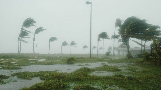
Jakarta (Greeners) – Indonesia’s Meteorology, Climatology and Geophysics (BMKG) declares current atmosphere condition indicates increase of weather pressure in Asia mainlands. In addition, potential cyclone spotted in northern part of Indonesia, including South China Sea. The agency also identifies tropical cyclone in Australia’s Carpentaria Bay, in southern part of Papua and Indian Oceans, in southern part of Java.
Kadarsah, head of climate change analysis of BMKG, said that the three cyclone seedlings spotted in Indonesia are 95P (southern hemisphere) in Carpentaria Bay with maximum 25 knots of wind speed in its center and 97W (west pacific) located in South China Sea with 20 knots in its center. Both are high potentials to transform into tropical cyclone within the next 24 to 48 hours.
“Those cyclone seedlings will potentially turn into tropical cyclone Lili which increases wind speed, sea wave height, and rains in several areas in Indonesia. Previously, BMKG has released a wave increase of 2.5 to four meters in Mentawai island to Sunda Strait triggered by tropical cyclone Kenanga,” said Kadarsah to Greeners, on Thursday (03/01/2019).
READ ALSO: Indonesia’s Meteorology Agency Warns Kenanga Tropical Cyclone Increases Wind Speed
Furthermore, Kadarsah said that current cyclone seeds are causing strong winds in several areas such as DKI Jakarta, West Java, Central Java, East Java, Lampung, Banten, West Kalimantan, South Kalimantan, East Nusa Tenggara, North Sulawesi, South Sulawesi, Southeast Sulawesi, North Maluku, Southern Maluku and West Papua.
“Each region have different wind speed. If global weather prediction, based on the picture, the wind speed is shown in numbers. For example, in Jakarta, the wind speed reaches 25 knots or 46.30 kilometers per hours,” said Kadarsah.
Nevertheless, the condition also occurs on hot weather because the Sun’s position on December, January, and February will be on southern hemisphere. Naturally, Indonesia will experience increasing temperature or hot weather.
“It means that without the cyclones, hot weather and strong winds can still happen,” he said.
READ ALSO: BMKG and Health Agency To Release Dengue Fever Early Warning System for Jakarta
The agency also warns people on the potentials of high tides in the country. Current sea wave in Indonesian waters are range between 1.25 to 2,5 meters, however, there are areas monitored higher, such as western waters of Lampung, southern waters of Java to Sumbawa, Indian Ocean south of Java to East Nusa Tenggara, Sermata Island to Tanimbar Island water areas, Kai Island to Aru Island, Arafuru Island, western waters of Yos Sudarso, southern waters of Merauke, Sangihe Island to Talaud Island, northern waters of Halmahera, northern part of West Papua to Papua.
Reports by Dewi Purningsih


